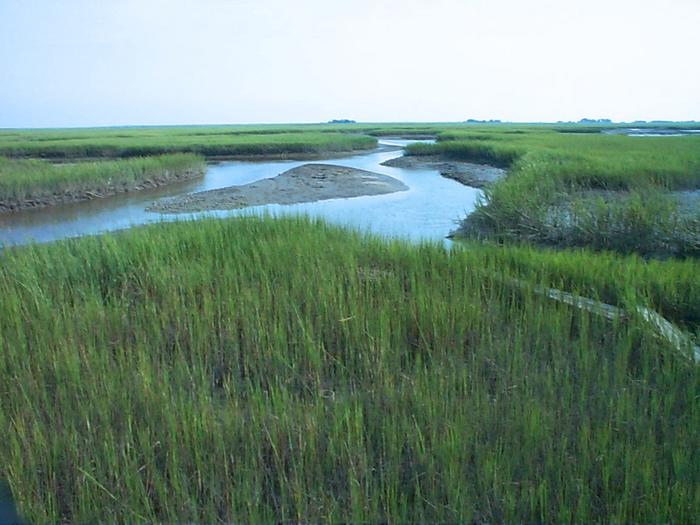
Nearly 450 monitoring stations show that almost every American coastal wetland is building itself upward, and that almost none is building fast enough.
A salt marsh stays a marsh by growing. Sediment arrives on the tide and is trapped by vegetation, roots and dead stems add organic matter from below, and the surface of the wetland rises. For as long as it rises at least as fast as the water does, the marsh persists. When it does not, the plants drown and the marsh becomes open water.
A study in Earth’s Future measures how that race is going along the coastline of the contiguous United States, and the result is uncomfortable in a specific way. Almost all American coastal wetlands are gaining elevation. Almost none are gaining it fast enough. Eighty-four per cent are gradually inundating, and many are on a path to becoming open water.
The work was led by Justine A. Neville of the Nicholas School of the Environment at Duke University, with co-authors from the US Geological Survey, the National Park Service, the US Fish and Wildlife Service and the University of Minnesota Duluth. Glenn R. Guntenspergen of the USGS Eastern Ecological Science Center is the senior author.
Elevation records against tide gauges
The study draws on data from nearly 450 monitoring stations, some of which have tracked wetland surface elevation for as long as twenty years, and compares those records against tide gauge measurements of local water level.
The pairing is what makes the analysis work. An elevation record on its own says only whether a marsh is growing. The comparison with the water tells you whether growing is enough, and it is the comparison that produces the study’s central number: 89 per cent of the wetlands surveyed are gaining elevation through sediment buildup, and only 16 per cent are gaining it fast enough to outpace sea level rise.
“Our study provides wetland managers with new information to help them make better-informed decisions and identify meaningful solutions,” Guntenspergen said.
Why building upward stopped being sufficient
The reason the margin has closed is that the water has sped up. Global sea level rose by an average of 1.7 millimetres a year over the twentieth century. Between 2006 and 2018 the average was 3.8 millimetres a year, more than double. A marsh accreting at a rate that was comfortable in 1950 can be losing ground now without having changed its behaviour at all.
What follows from losing that race is not a gradual thinning but a collapse, because marsh plants have a flooding tolerance and then they do not. “All coastal plants have optimum ranges,” Guntenspergen said. “But if they get flooded too much, then the system shuts down. The plants decrease production and eventually die.”
That is a feedback as much as a threshold. Plants are the mechanism by which the marsh traps sediment and adds organic matter, so when flooding stress reduces plant production, the surface builds more slowly, which deepens the flooding.
The Gulf fares worst
The picture is not uniform. Gulf Coast wetlands fare worst in the analysis, while parts of the Atlantic Coast appear comparatively resilient: about 75 per cent of Atlantic monitoring stations show submergence slow enough to rule out a critical threat.
That phrasing is worth reading precisely. Ruling out a critical threat is not the same as finding that a marsh is safe, and the Atlantic stations are mostly in the category of inundating slowly rather than the category of keeping up. The regional contrast is one of pace, not of direction.
Room to retreat
The other way a wetland survives rising water is horizontally. Rather than building upward in place, it migrates inland, colonising low ground that used to be dry. The study finds that 73 per cent of US coastal wetlands could still do this, provided the land behind them is not too steeply sloped and no structures stand in the way.
Those two conditions carry most of the weight. Slope is fixed, and the built environment is the part that is in principle negotiable and in practice very hard to negotiate, since the low ground immediately behind a coastal marsh is frequently a road, a sea wall, a housing development or farmland. Guntenspergen put the scale of the management problem with some understatement: “The logistics are quite daunting,” he said.
“Not all doom and gloom”
Neville was not taken aback by the headline figure. “I was not very surprised, to be honest,” she said. “Yes, there is an urgency to understand what’s happening with our wetlands.”
She was also careful not to let the 84 per cent stand as the whole finding: “It’s not all doom and gloom,” she said. The 73 per cent with migration room, and the Atlantic stations where submergence is slow, are the parts of the result that leave something for managers to work with.
What the design can and cannot show
This is an observational study, and several limits follow from that. A surface elevation table measures a point, not a whole marsh, and the behaviour of a station does not automatically describe the hectares around it. The nearly 450 stations are also not evenly distributed along the coast, which means the regional comparisons rest on uneven sampling.
Nor does the study put dates on anything. It reports whether wetlands are currently keeping up with current rates of rise, not when any particular marsh will convert to open water — and since the rate of rise is itself still increasing, today’s deficits are a baseline rather than a forecast.
What the study does establish is a diagnosis rather than a prognosis, and a more useful one than a simple loss estimate would be. Knowing that 89 per cent of wetlands are accreting and only 16 per cent are accreting enough points at a different set of interventions than knowing only that wetlands are disappearing. Sediment supply is doing something nearly everywhere; it is doing enough almost nowhere.
The authors report no conflicts of interest. The release does not state the study’s funding sources.
Notes
- Neville, J.A., Kovalenko, K.E., Snedden, G.A., Osland, M.J., Thorne, K.M., Feher, L.C., Moorman, M.C., Moon, J.A., Krauss, K.W., Grace, J.B., Lane, T.C., Sanspree, C.R., Cahoon, D.R., Guntenspergen, G.R. “Ecological transformations of coastal wetlands of the conterminous United States in response to contemporaneous sea-level rise.” Earth’s Future, 2026. DOI: 10.1029/2025EF006836.
- American Geophysical Union. “Rising seas are swallowing the vast majority of US coastal wetlands.” EurekAlert!, 3 August 2026. https://www.eurekalert.org/news-releases/1138147.
James Morris, 2002


Leave a Reply