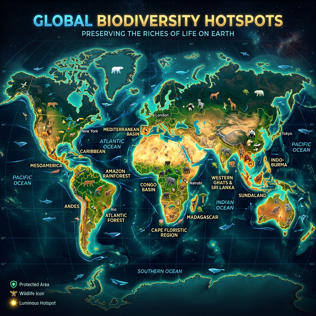
Running 33,604 vertebrate species against seven threats rather than one, an IIASA-led team found that nearly a fifth of the priority areas would be missed by looking at habitat loss alone.
The idea of a biodiversity hotspot has been doing heavy lifting in conservation for decades. Identify the places with exceptional concentrations of species found nowhere else, note which of them are under pressure, and you have a shortlist for where limited money should go.
The influential version of that calculation combined endemism with habitat loss. A study in One Earth, led from the International Institute for Applied Systems Analysis, argues that one kind of pressure is not enough, and that adding the others moves the map.
Analysing 33,604 terrestrial vertebrate species from the IUCN Red List, the team classifies about 13 per cent of global land area as a vertebrate hotspot. Nearly one in five of those areas would be missed if only habitat loss were considered.
Seven threats instead of one
The framework weighs seven major threats, among them hunting, pollution, invasive species, climate change and land-use change.
Those operate differently enough that a map built on one will not resemble a map built on another. Habitat loss is visible from orbit and correlates with roads, farms and cities. Hunting pressure can empty an intact forest without changing how it looks from above — the phenomenon sometimes called an empty forest, where the canopy is undisturbed and the large vertebrates are gone. Invasive species devastate islands that are otherwise pristine. Climate change threatens mountaintop and high-latitude species whose habitat is not being cleared at all but is moving out from under them.
“Our findings show that different parts of the world face very different combinations of threats, and that there is no one-size-fits-all solution to protecting biodiversity,” said Jonas Geldmann, associate professor at the University of Copenhagen’s Center for Macroecology, Evolution and Climate and the study’s senior author. “By bringing together information on where species occur and the pressures they face, we can better inform decisions about where and how to invest in conservation.”
The practical consequence is that the threat determines the remedy. A hotspot defined by hunting needs enforcement and alternative livelihoods; one defined by invasive species needs eradication programmes; one defined by climate needs connectivity so species can move. Drawing a protected area boundary addresses the first kind of problem and may do very little about the others.
Thirteen per cent, and who lives there
The figure that complicates everything is demographic: these hotspots are home to more than a third of the global human population.
That follows from where the hotspots are. Many fall in tropical regions and broadleaf forests, which is also where a large share of humanity lives, and the overlap is not accidental — the conditions that support high biodiversity, warm climates with reliable rainfall and productive land, are the conditions that support dense human settlement.
It makes the framing of conservation as the protection of empty wilderness untenable for most of the areas that matter most. Whatever happens in these places happens with, through or against the people living in them, and a priority map that identifies land without identifying its inhabitants is only half a plan.
The 13 per cent figure also invites comparison with the Kunming-Montreal Global Biodiversity Framework, whose 23 targets are to be met by 2030 and whose best-known commitment is to protect 30 per cent of land and sea. A hotspot map covering 13 per cent sits comfortably inside that: the areas identified here could in principle be covered without exhausting the target, which is a more encouraging arithmetic than conservation usually offers.
Built to be revised
The authors emphasise the framework’s transparency and reproducibility over its specific output, which is a notable choice of emphasis.
“Another advantage of our approach to mapping biodiversity hotspots is that it can be updated as new information becomes available,” said Harith Farooq of the Faculty of Natural Sciences at Lúrio University in Pemba, Mozambique, the study’s lead author. “In this study we focus on terrestrial vertebrates, but the same framework could eventually incorporate plants, insects and other organisms, giving us a more complete picture of global conservation priorities.”
The vertebrate restriction is the study’s main acknowledged limit, and it is a large one. Vertebrates are a small fraction of described species and a smaller fraction of actual diversity; insects alone outnumber them by orders of magnitude, and plants carry much of the ecological function in any ecosystem. A map of vertebrate hotspots is a map of where the best-documented animals are, which correlates with but does not equal a map of biodiversity.
That is less a criticism than a description of the available data. The IUCN Red List is far more complete for mammals, birds, amphibians and reptiles than for anything else, and a reproducible framework that can absorb new assessments as they arrive is a reasonable response to that constraint.
What a map is for
“Identifying areas that are home to exceptionally high levels of unique biodiversity while also facing threats from human activities provides the information decision makers need to help turn the tide on the global biodiversity crisis,” said Piero Visconti, who leads the Biodiversity, Ecology, and Conservation Group at IIASA.
The claim is about information rather than outcomes, which is the honest version. Priority maps have a mixed record: they shape funding and attention, and they have also been criticised for directing resources according to where data is good rather than where need is greatest, and for treating conservation as a spatial problem when much of the pressure comes from consumption elsewhere.
What this version adds is the explicit demonstration that the answer depends on the question. Hotspot locations change depending on which threats are included, and a framework that makes those choices visible is harder to use as though its output were simply the truth about where biodiversity is.
The study’s other listed authors are M.B.J. Harfoot and Carsten Rahbek. The release does not state the study’s funding sources, noting only that IIASA is funded by research agencies in Africa, the Americas, Asia and Europe.
Notes
- Farooq, H., et al. One Earth, 2026. DOI: 10.1016/j.oneear.2026.101866.
- International Institute for Applied Systems Analysis. “13% of Earth’s land identified as biodiversity conservation hotspots.” EurekAlert!, 19 October 2026. https://www.eurekalert.org/news-releases/1148239.


Leave a Reply