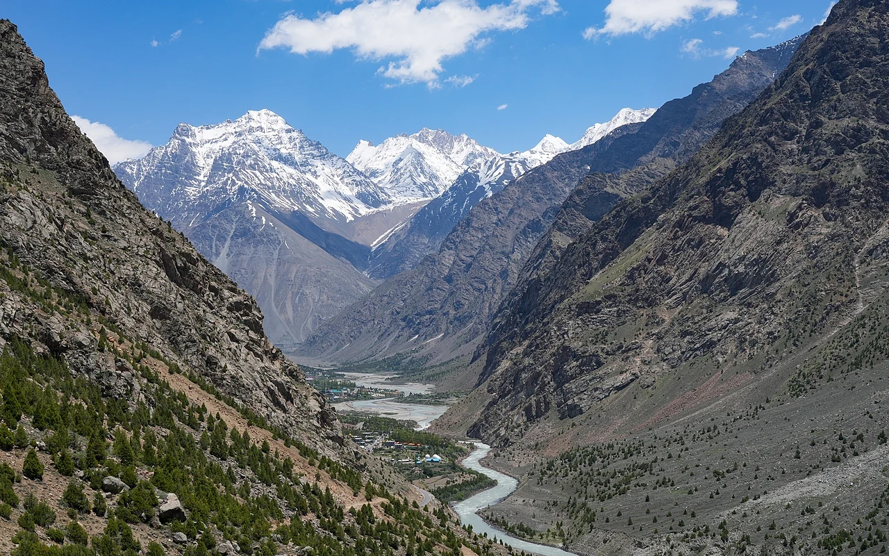

The Bhaga River is one of the major rivers in the Lahaul region of Himachal Pradesh, India. It originates from the Suraj Tal lake near the Baralacha La pass in the Himalayas, at an elevation of approximately 4,890 meters (16,043 feet) above sea level. The river flows through the picturesque Lahaul Valley, characterized by its stunning alpine landscape and harsh climate.
From a scientific perspective, the Bhaga River exhibits several interesting characteristics. The river’s flow is primarily fed by glacial melt and snow melt, making it a crucial indicator of climate change impacts in the region. The river’s discharge varies significantly between seasons, with peak flow occurring during the summer months when glacial melt is at its highest. The water temperature typically remains very cold throughout the year, rarely exceeding 10°C (50°F) even during summer months, due to its glacial origin.
The river’s geomorphology is particularly fascinating, as it has carved deep valleys through the ancient metamorphic and sedimentary rocks of the Lesser Himalayas. The river basin contains various geological formations, including schists, gneisses, and quartzites, which provide valuable information about the region’s tectonic history. The steep gradient of the river results in significant erosional power, leading to the formation of distinctive V-shaped valleys and numerous rapids.
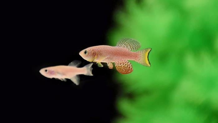
The Bhaga River’s ecosystem supports unique high-altitude aquatic life adapted to cold waters and low oxygen conditions. The river is home to several species of snow trout (Schizothorax species) that have evolved specialized physiological adaptations to survive in these extreme conditions. The riparian zones along the river also host specialized plant communities that can withstand the harsh mountain environment and seasonal flooding.
One of the most significant hydrological features of the Bhaga River is its confluence with the Chandra River at Tandi, where they merge to form the Chandrabhaga River (also known as the Chenab River). This confluence point, situated at approximately 2,800 meters (9,186 feet) above sea level, represents an important hydrological and cultural landmark in the region.


Leave a Reply