For much of the nineteenth century, places like Newtown and Flushing were shaped by their relationship to water. Creeks, marshes, bays, and tidal inlets were not peripheral features of the landscape; they were part of its logic. They helped shape settlement, work, travel, trade, and the daily rhythms of life. Flushing Creek, like so many waterways in the history of New York, was once a visible and consequential presence—part boundary, part passage, part resource, part living system. It reminded us that land and water were intertwined.
That intimacy has been lost. Over generations, development, landfill, industry, highways, and the rerouting or burial of waterways have altered the landscape. What’s more, we have lost our ability to read it. Yet, water still governs far more of urban life than many New Yorkers realize. It often does so from behind retaining walls or beneath pavement or at the edges of public attention. We move past these places without seeing them, our detachment from the waterways complete. Our estrangement includes the histories waterways like Flushing Creek carried.
Cody Herrmann’s work pushes against that forgetting. An artist, organizer, educator, and longtime advocate connected to Guardians of Flushing Bay, Herrmann has spent years asking how people might be brought back into relationship with Flushing Creek and the larger water system around it. Through walking tours, environmental advocacy, public storytelling, and socially engaged art, she invites people to look again at what the city has taught them to overlook. In her work, the creek is not just damaged infrastructure or neglected urban fringe. It is a place of memory, pressure, ecology, and possibility.
Dig deeper and Herrmann’s work clearly becomes quest for historical recovery. To reconnect with a waterway is, in part, to recover an older way of seeing—to remember that communities were once organized around these currents and shorelines. The lens she provides traces those relationships that still endure beneath the modern city. In the conversation that follows, Herrmann reflects on how Flushing Creek came into focus for her, what it means to practice stewardship in a place so shaped by neglect and redesign, and why learning to see an urban waterway again may also help us find our way back to the past.

You grew up in Flushing, but Flushing Creek and that whole area only really came into focus for you when you were in your twenties. How did that happen, and what was that moment like?
I spent a lot of time on the 7 train, looking out the window and wondering, what is this land between Flushing and everything else? That whole 150-acre stretch from the edge of downtown Flushing to the other side of Citi Field always felt inaccessible. There weren’t really things to do there, and people weren’t taught about the reasons those areas felt off-limits.
As I got older, I kept staring out that train window and thinking: What is this? What is that river, and why don’t we talk about it? Especially once I started doing more environmental advocacy, those questions became harder to ignore. I was doing a lot of thinking about stewardship outside New York City, but in college I really started thinking about experiential stewardship and the value of “non-expert experts.” What does lived experience mean? What kind of knowledge comes from that?
At a certain point I decided I wanted to work in my own neighborhood and do advocacy and stewardship there. So I started digging into local environmental issues and basically Googled the worst environmental problem in my neighborhood. That led me to combined sewer overflow, and to questions of access to Flushing Bay and Flushing Creek. I started to see the area as a microcosm of environmental justice issues. Everyday people might not think about these waterways all the time, but developers and politicians have been thinking about them for decades. That tension really inspired a lot of my work.

Have you always had this advocacy side to your work, or is that something that developed later?
I think I’ve always had an interest in speaking up about things that don’t seem equitable, things that feel unfair, and in demystifying institutional power. That impulse has always been there. What I didn’t realize at first was that those same dynamics existed right at home, in my own backyard. Any person living in any community can tap into those issues wherever they are.
For me, it’s not so much about saying, “I love water, I love this waterway.” It’s more that I love this neighborhood, and this is something affecting the neighborhood and its quality of life. What if we talked about it? What if we cared about it? What if it were spoken about and written about more? If people had that awareness, how would that feedback loop create a healthier place to live?
That has really been the question I’ve been running after for the last ten years: How do you communicate ecological issues to the populations they impact? That question has centered me here at home in Queens, which I love.

How has your approach to answering that question evolved over those ten years?
Early on I was really inspired by human-centered design practices, the kind of methods often used in urban design and public engagement. My work started with workshops: listening to people, gathering feedback, asking what they thought about these waterways, how they interpreted them in daily life, what it would take to get them there, what it would take for them to learn about these places, and how they wanted to learn.
Those workshops really shaped the work that came later, which became much more rooted in socially engaged art than in human-centered design facilitation. I went through this progression where I thought I was going to be an urban ecologist, and then thought maybe I’d be an urban designer. Then the urban designers sort of told me, actually, we think you’re a socially engaged artist, and encouraged me in that direction.
It’s not lost on me that a lot of what I thought of as academic or urban-design thinking was treated as art because it was seen as too idealistic or too imaginative. The ways I wanted to work with people and communities were framed as art, not as something that should be built into formal institutional expertise. So now I push back against that idea. I feel lucky to be working in a moment when artists are increasingly being invited into planning processes.
When we talk about land use in a place like Flushing Bay or Flushing Creek, it really comes down to whose imagination you’re living in. So much of what we experience is based on what Robert Moses imagined. Art, community-engaged art, and social practice art allow other people to imagine too. That’s incredibly powerful in urban design, land use, and in how we move through cities. We are always living inside someone’s design. Someone imagined this. I hope my work helps level that field so more people can imagine the future too.
That’s a really interesting way of putting it. How do you approach the historical aspects of your work? You just brought up Robert Moses and the idea that we’re still living inside his imagination.
A lot of my work focuses on the last thirty years. Many of the projects I highlight are very contemporary. But the walking tours I do really open the door to asking: How did we get here? Again, it goes back to that idea that someone designed this, someone put this here, and it wasn’t always like this.
Even though I often focus on recent decades, there’s a lot of opportunity to talk about Indigenous communities, about how they used the land, how they were pushed out, and how those histories connect to how the land is seen and used today. The Matinecock are still here. Descendants of the communities that were here before colonization are still here.
Through Guardians of Flushing Bay, I’ve been lucky to work with artists like Tecumseh Caesar and others connected to the Matinecock Nation, who can shed light on those longer historical perspectives. We’ve done walking tours together, and I always find those experiences fascinating because they expose the contrast between how I might speak about something and how an Indigenous person might speak about it.
Even something like Phragmites, which I might describe as an invasive introduced species from a contemporary ecological perspective, can be understood very differently through an Indigenous perspective. I think it’s important not to hide those contrasts. I’m a contemporary white woman speaking from one position; someone from a long-standing Indigenous nation brings another. Making that visible helps people imagine multiple perspectives and see how their own sense of agency affects how land is understood and shaped.

Are those Indigenous communities clustered anywhere around Flushing today, or are they more dispersed?
They’re definitely not clustered in one place. It’s more of a diaspora. Some of the strongest tribal communities on Long Island are places like the Shinnecock Nation, so there are people who connect through those communities. Institutions like Flushing Town Hall and the Queens Museum do a good job of honoring Indigenous histories through cultural events. Queens Farm does too, though that’s a bit farther away.
Let’s talk about Flushing Creek itself. How would you describe it? I know that’s broad, but you spend a lot of time there. What are the shorelines like? What’s the water like?
Flushing Creek is a really interesting water body in New York City, and I’m completely biased, but it does have some quirks. One is that it actually flows north, up toward the East River, and it takes up the whole length of Flushing Meadows–Corona Park.
A lot of people don’t realize that many of the bodies of water in Flushing Meadows—Willow Lake, Meadow Lake, even those little pools you see near soccer fields—are all part of Flushing Creek. The waterway was constrained, repositioned, reimagined, and redesigned by Robert Moses. Almost every shoreline, except for some portions of the non-tidal or tidal edges, is man-made. Again, this is something someone envisioned.
Most of the park is freshwater, and the biggest inflow into that non-tidal portion isn’t some pristine stream system. It’s stormwater runoff from the highways that ring the park. In theory there is groundwater movement under the Jamaica rail yards flowing north, but the hydrodynamics are poor. In practice, the biggest source of freshwater is roadway runoff. So you get this strange environment that is supposed to be freshwater, but when you test it for salt, the levels are high. That raises real questions about what kind of habitat it is actually supporting.
Then as you move north out of Flushing Meadows–Corona Park, you reach the Tidal Gate Bridge. Robert Moses built that to keep sewage overflow and the gross tidal brackish water out of the park, while also managing flooding. It really created a dividing line between two very distinct sections of Flushing Creek.
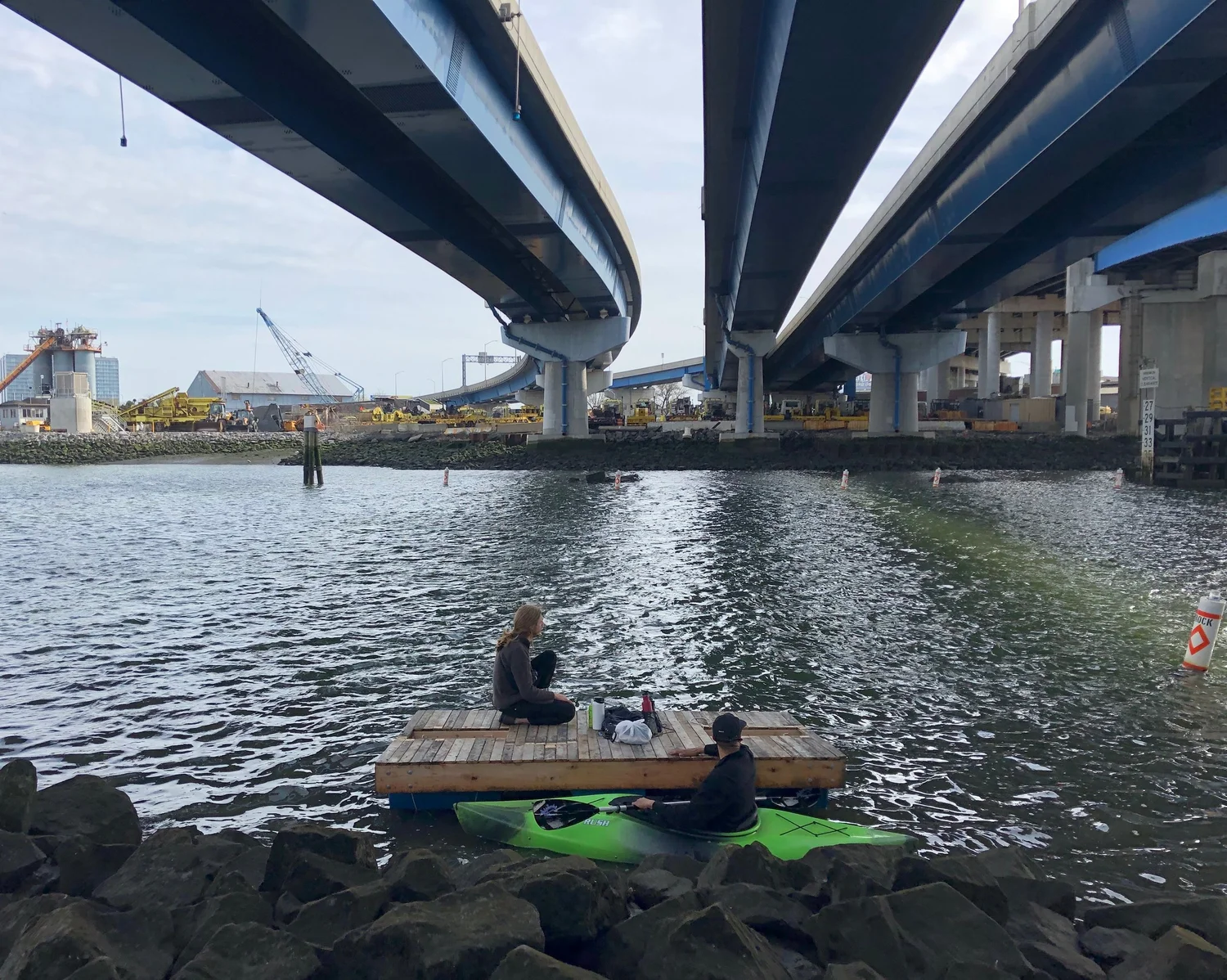
North of that bridge, around the Long Island Rail Road tracks and up toward Flushing Bay, you get the tidal section. That’s my favorite place in the world. It’s a saltwater mudflat flanked by downtown Flushing, Willets Point, and all the changes happening there. Historically this is the Valley of Ashes. And when I’m there, I still feel that capitalist, almost godlike force that Fitzgerald captured through the eyes of Dr. T. J. Eckleburg in The Great Gatsby. That description from the second chapter still feels fitting.
There is construction, there are obstructions, there’s a lot you can’t see, but you feel the intensity. You know people are thinking about this place. The tidal portion includes restored wetlands from 2013, and wetlands that are actively being restored now. One side is lush, green, and relatively clean-looking. The other side butts up against downtown Flushing and industrial waterfront that hasn’t been developed for decades—very intentionally, because of speculative real estate.
Like so much of our waterfront, you can feel the tension and the potential. In that short stretch of tidal Flushing Creek—maybe half a mile at most—you see a natural-looking wetland, New York’s industrial harbor, and the city’s post-9/11 shift from industrial zoning toward mixed-use commercial and residential development. There’s aggregate industry, asphalt, rock, cement—more than on most tributaries in the city. And then there’s the adjacent pressure of changing waterfront development.
That’s why the walking tours work. The inequality is visible. People can see there is no access, no clear wayfinding, no honoring of the ecology that’s there. And then when you start explaining that this is effectively a sewer, that huge tunnels are pumping out billions of gallons of raw sewage annually, it really blows people’s minds.
Do you still give tours?
I do, though not as often as I used to. I had a full-time job until recently and was laid off, so maybe I’ll start applying for funding to do more of them again. I still usually do at least two a year with Guardians of Flushing Bay, and sometimes more if there’s funding.

When did the restoration work begin?
There are a lot of different restoration timelines, depending on what you mean. One important piece is the Long Term Control Plan, which is New York City’s plan for addressing combined sewer overflow. The Flushing Creek plan came out in 2014. Then in 2015 you had the Flushing West redevelopment plan. So at the same time the city was talking about remediation and environmental cleanup, it was also planning major rezonings and development.
Unfortunately, those things tend to go hand in hand. Once the market shifted after 2008 toward big development and speculative real estate, restoration projects started to bubble up again too. Around 2007, under Bloomberg, you see the push for urban renewal in Willets Point. It feels like everyone started looking at the area at the same time.
The west side shoreline of Flushing Creek between Roosevelt Avenue and Northern Boulevard was redone, I believe by DEP, around 2013. It’s a very textbook restored wetland shoreline. There’s erosion, so it’s not holding up perfectly, but it functions. South of Roosevelt Avenue, near Skyview and down toward the Tidal Gate Bridge, the Army Corps of Engineers has been doing more restoration and replanting vegetation.
The frustrating part is that the Long Term Control Plan, even though it was approved by the state more than a decade ago, is still moving through city processes. And the actual plan does not eliminate the sewage overflow. It just chlorinates the discharge and then dechlorinates it.
That’s a problem because the biggest thing preventing human recreational use of Flushing Creek is water quality. It has some of the worst water quality in the city because of combined sewer overflow, due largely to the way the catchment areas are designed. Community-collected data consistently shows some of the highest bacteria levels in the city there. It’s disgusting.
The concern is that this chlorination project could also threaten the restoration that has already happened and the restoration planned for Flushing Bay, especially oyster restoration. It’s a very uncertain form of infrastructure. If it goes wrong, it could set us back decades.
There’s also a more philosophical question here. I remember standing by Flushing Creek once with a longtime Parks Department staffer, looking out over a restored wetland. He raised the question of whether it is morally acceptable to restore the cosmetic or visible edges of a waterfront and track bird life there when you know the water and the sediment are still polluted. Birds flying overhead just see green and habitat. They don’t know the sediment is contaminated, or that the things they eat there may also be contaminated. So is it right to attract more life into a place where the larger environmental problems remain unresolved? I think about that a lot.
You mentioned different habitats along the creek. What are those habitats like?
The creek is definitely alive. I don’t want to give the impression that there’s no life there, because there is. In the tidal portions you can find skillet fish, wild oysters, mussels, eels—there’s all kinds of life.
But again, there’s a very distinct difference between the non-tidal and tidal sections. On the Flushing Meadows side, you’re dealing with highly landscaped habitat. That’s habitat for people too—it’s a park. That’s very different from the more untouched, industrial, and inaccessible parts.
When I look at Flushing Creek, I’m always trying to read the landscape. Plants tell us things. They reveal what’s happening underneath. One of the most obvious signs there is the overgrowth of Phragmites. Phragmites thrive in disturbed wetland environments. So when you see them dominating the shoreline, you know something happened. The water was disturbed, the original ecosystem was made vulnerable, and then the Phragmites took over.
From the lower, non-tidal areas near the rail yards all the way to the mouth of the creek between Willets Point and Flushing, you see that everywhere. To me, it says the shoreline has been shaped, touched, and moved over and over again. The ecosystem tells you that. It’s very clear.
Where you don’t see overwhelming opportunistic growth like that tends to be where contemporary restoration has taken place. So you can almost read the timeline of intervention through the plants. I’m reading ecological signs through a sociological and historical lens—trying to understand how humans built this environment by looking at vegetation.
On restored shorelines, you can see it almost diagrammatically: intertidal zones with Spartina, then low brush just above the high tide line, then cottonwoods a little farther back, which are very common on urban industrial waterfronts. In that sense, Flushing Creek is a good beginner habitat to read. It’s simple enough that you can visibly see environmental degradation, urban design, and restoration all layered together.
I’m very interested in patch dynamics and landscape theory—the idea of understanding a landscape as a collection of patches. What I love about that framework is the attention it pays to edges, the spaces between patches, because that’s often where the most diversity appears. Water is an edge. Especially in New York Harbor, it is a boundary zone, and those edges can generate diversity, and diversity creates resilience.
So I think about Flushing Creek as an edge in multiple ways: ecologically, between parkland and private land, between jurisdictions, between political boundaries. The habitat is deeply shaped by the diversity those edges bring.

Are there any portions of the creek that are even close to natural?
If you look at old aerial imagery, one of the things that stands out is that the curve around downtown Flushing and Skyview is still visible over time. That shape feels like one of the few remnants of something closer to the natural shoreline. But overall, there really isn’t much natural shoreline left.
Even Flushing Bay, including the LaGuardia side with its curved form, was heavily filled and remade. And of course nothing there is untouched in any pure sense. Everything has been altered. There’s no old-growth forest along Flushing Creek. Every inch has been touched.
And when you look at planning documents today, there isn’t a single inch of Flushing Creek that isn’t being looked at by developers, planners, agencies, or all three. It’s remarkable to think about a body of water being scrutinized that intensely.
The second installment of our conversation with Cody Herrmann drops next week. Stay tuned!
IMAGE CREDIT: Cody Herrmann.


Leave a Reply