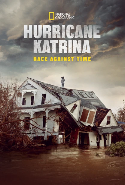
To mark the 20th anniversary of Hurricane Katrina, Hurricane Katrina: Race Against Time offers a harrowing, moment-by-moment account of the disaster that devastated New Orleans and exposed deep failures at every level of government. Produced by the award-winning team at Lightbox alongside filmmaker Ryan Coogler’s Proximity Media and directed by Oscar-nominated Traci A. Curry, the series blends searing eyewitness testimony with immersive archival footage to challenge long-held myths and lay bare the human, political, and societal costs of the catastrophe. In this Q&A, Dr. Ivor van Heerden—whose storm surge modeling at LSU offered prescient warnings before the levees failed—reflects on the lessons still unheeded, the scientific advances since 2005, and the critical truths many Americans still misunderstand about the storm and its aftermath.
Let’s start with a basic question. It’s been nearly 20 years since Hurricane Katrina. How do you feel the warnings from the Hurricane Pam exercise—and from Katrina itself—have been received? Have those lessons finally been understood, or are they still being ignored?
Well, the lessons from Hurricane Pam were largely ignored, both before and after Katrina. You rarely hear anyone talk about the findings from Pam anymore. As for Hurricane Katrina, I don’t think the U.S. Army Corps of Engineers has truly learned its lesson.
Here’s why: The Corps considered Katrina to be a one-in-300-year storm. But we know it was actually closer to a one-in-30-year storm. The National Hurricane Center even classified it that way at one point.
So if you base your repair and design assumptions on Katrina being a one-in-300-year event—but then design infrastructure for a one-in-100-year event—you’re already building in vulnerabilities. You’re not making the levees high enough.
A few years ago, the Corps admitted that while their post-Katrina repairs were robust, they failed to account for two critical factors: natural subsidence, which along the Gulf Coast averages about 2.5 feet per century, and global sea level rise due to climate change.
They also didn’t factor in that hurricanes are now larger, stronger, and more frequent. Because of these oversights, they’ve had to admit the system was under-designed. Now they’re having to raise the levees and other protective structures again.
And here’s the kicker: Not one official from the Corps of Engineers lost their job after Katrina. No one was held accountable. And the Corps has never formally apologized for what happened.
Your modeling program at LSU was ahead of its time. What were some of the key findings from that work?
I was fortunate that the State of Louisiana used some tobacco settlement funds to let me set up the Hurricane Public Health Research Center. It was multidisciplinary and multi-university, covering everything from storm dynamics and flooding to the public health implications and disease risks.
We modified an existing storm surge model and, thanks to an $11 million supercomputer gifted to LSU by the governor, we could run very detailed simulations. By the time Katrina hit, we had a high-resolution storm surge model that could produce updated projections every four hours.
We supplied those outputs to the state emergency operations center, chemical companies, the media, law enforcement—anyone who needed them. You could see real-time animations of the storm surge approaching.
We also tackled data integration. Different parishes had different databases—schools, hospitals, hazardous sites—so we developed a unified GIS system for the region. It had secure access and proved vital for rescue and response.
Another key contribution: our transportation engineers helped develop the contraflow system to evacuate New Orleans. They even conducted a successful test run before Katrina, and during the actual event, it worked. Almost everyone with a car got out safely.
We also knew from our public opinion surveys that about 120,000 New Orleans residents didn’t own cars. To reach them, we distributed cell phones in low-income areas so they could be included in our surveys.
We worked closely with state agencies and emergency responders, holding advisory meetings every four to six months to share findings. We also collaborated with veterinarians to prepare for the massive number of stranded animals—something people often overlook.
When Katrina came, we were the go-to team for storm surge modeling and GIS. The state didn’t even have its own mapping expertise. I remember the governor had me attend all press conferences, and the state was using a tourist road map. We quickly produced accurate maps.
After the storm, people trapped in their homes texted their addresses. We converted those into coordinates and loaded them onto GPS units for rescuers. I even went out myself in a boat, measuring flood depths and negotiating with a French satellite company to get overhead images. That data was crucial since all other communication systems were down.
How have modeling techniques evolved since 2005? Are we better at forecasting storm surge and levee stress?
Yes. Storm surge modeling has improved. The ADCIRC development group has continued refining the model. We were lucky to have LIDAR data for Louisiana before Katrina, giving us very precise elevation models. More coastal areas now realize they need similar surveys.
As for levees—just look at the Dutch. They’ve written the book on flood defense. For years, there was a kind of arrogance within the Corps of Engineers: a belief that we didn’t need outside help. But Katrina changed that. We’ve since adopted some of the Dutch methods, which you can see in the more robust levee systems and floodgates being built now.
Given climate change and warming oceans, are the physical scale models of hurricanes still valid? Or do they need to be recalibrated?
If you mean scale models—physical representations—they’re not effective anymore. The dynamics are just too complex. You need to work with advanced computer simulations.
The model we used had 70,000 lines of code. That’s the level of complexity we’re talking about. After Katrina, we began integrating SWAN, a wave model, with ADCIRC, the storm surge model. That let us see both surge and wave impact.
Waves are what really destroy structures. In New Orleans, the houses flooded by levee breaches remained mostly intact—roofs and walls still there. But on the Mississippi coast, where there was both massive surge and 9-foot waves every five seconds, everything was obliterated.
Have we fully applied this knowledge? No. I’ve recently worked on projects for new chemical plants being built in Louisiana. Based on storm surge projections, it’s clear they’re going to be underwater within their expected 50-year lifespan.
Sea level rise in Louisiana is accelerating. In the next 70 years, we’re looking at a four-foot rise. That’s not just along the shore—it’s over a massive area. More water, less friction on the surge, and bigger waves. A Category 4 or 5 hurricane hitting Louisiana today would bring unimaginable destruction.
For this documentary, what do you think are the biggest misconceptions the public still holds about Hurricane Katrina and its aftermath?
Two things stand out. First, the idea that the levees failed because of local government mismanagement is absolute nonsense.
Second, there’s the belief that the suffering was somehow the fault of the people themselves. That’s simply not true. The real blame lies with the federal government—both for the Corps’ failure to build adequate levees and for FEMA’s failure to respond effectively when it mattered most.


Leave a Reply