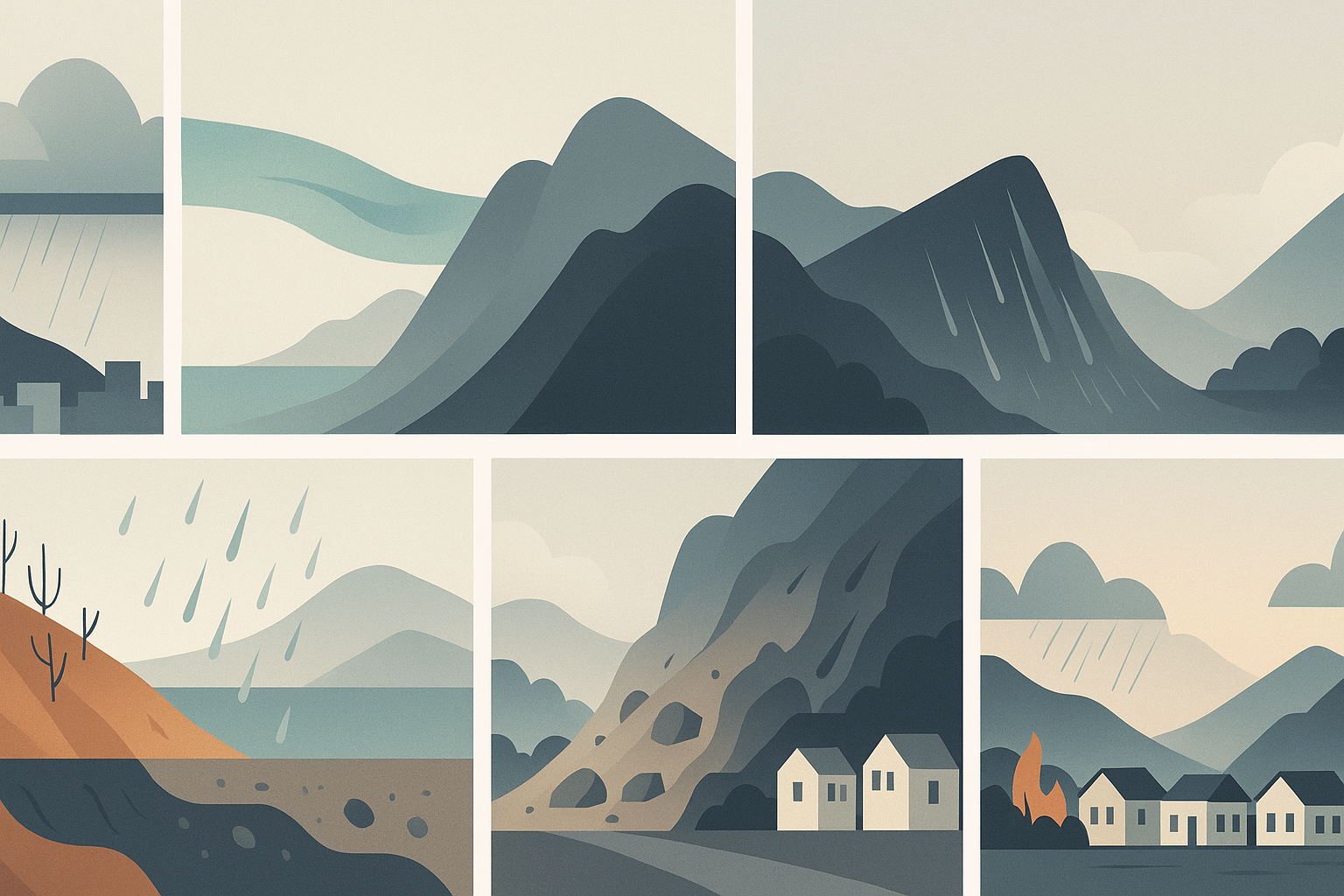
Southern California’s latest deluge isn’t just “bad weather.” It’s a textbook example of how atmospheric physics, geology and wildfire ecology stack the deck for dangerous mudslides and debris flows.
CNN’s forecast centers on a strong Pacific storm, juiced by an atmospheric river, that’s dumping inches of rain on Los Angeles and surrounding mountains over several days. The biggest concern: steep canyons above densely populated neighborhoods that burned in January’s catastrophic fires, like the Palisades and Eaton burn scars.
The atmospheric river: a water-vapor firehose
The storm hammering California is being fed by an atmospheric river (AR) – a long, narrow band of very moist air stretching thousands of kilometers across the Pacific. Think of it as a horizontal conveyor belt moving water vapor from the subtropics toward the West Coast.
On average, a single AR can carry as much water vapor as the Mississippi River discharges as liquid water at its mouth; the strongest can transport many times more. When one of these vapor plumes hits California’s coastal mountains, the air is forced upward, cools, and condenses that moisture into intense rain or high-elevation snow.
In this case, forecasters are dealing with a slow-moving storm whose core energy and moisture are lingering over Southern California instead of sweeping quickly inland. That raises the odds of prolonged heavy rain and high short-term rainfall rates—exactly the combination that triggers landslides.

Why Southern California hills fail so easily
Geologically, Southern California is primed for slope failures. Its mountains—the Santa Monica, San Gabriel, and San Bernardino ranges—are young, steep, and actively rising along fault systems. Rock is often fractured and weak, overlain by thin soils perched on slopes that can exceed 30–40 degrees. Classic USGS work in the region has shown that “soil slips” during intense storms can rapidly transition into debris flows, causing death, injury, and significant property damage.
Under “normal” conditions, vegetation and soil structure help intercept rainfall and keep hillslopes stable. Roots bind the soil, leaf litter slows runoff, and pores in the soil absorb water. But wildfires erase many of these protections in a matter of hours.

Burn scars, hydrophobic soils, and debris flows
When fire tears through chaparral and forest, it unleashes a triple threat that turbo-charges flood and mudslide risk. First, it strips away vegetation and organic litter, leaving bare soil exposed. With leaves and roots gone, raindrops hit the ground directly, knocking particles loose and rapidly generating runoff. Second, the intense heat actually bakes the soil surface, creating a “hydrophobic” or water-repellent layer as organic compounds vaporize and condense lower in the soil profile. Water beads and runs off instead of soaking in—imagine trying to pour water onto a waxy surface. Third, the fire loads channels with loose debris: burned branches, ash, and loose rock fill gullies and channels, ready to be mobilized into a deadly slurry.
As a result, it takes much less rain to trigger debris flows in burned basins than in unburned ones. USGS observations in Southern California show that as little as 7 mm (0.3 inches) of rain in 30 minutes has triggered debris flows on burn scars, and any storm with intensities above about 10 mm/hour (0.4 in/hr) is considered high-risk.
A debris flow is not just “mud.” It’s a fast-moving slurry of water, boulders, soil, and logs that behaves more like wet concrete. Flows can barrel down canyons at tens of miles per hour, uprooting mature trees and smashing homes even when total rainfall isn’t especially impressive.
Because the January fires were so destructive—and burned right up against suburban neighborhoods—officials now worry that concentrated bands of heavy rain will send debris flows into streets, backyards, and highway corridors below the Eaton, Palisades, Hurst, and Sunset burn scars.

How scientists forecast debris-flow danger
Debris flows are hard to predict at the level of a specific canyon, but scientists have gotten much better at mapping where and when they’re likely.
After major wildfires, the USGS and state geologists run post-fire debris-flow hazard assessments. These models use burn severity, slope steepness, soil type, and drainage density, combined with “design storm” intensities, to estimate the probability and potential volume of debris flows. The results are maps that emergency managers use to decide which neighborhoods may need evacuation orders during heavy rain.
Real-time, meteorologists track atmospheric rivers via satellites that measure water vapor, and radar and rain gauges that track where the heaviest bands are stalling. NOAA has even emphasized how coastal ocean temperatures and currents can feed extra heat and moisture into ARs in the days before landfall, affecting their intensity.
On the ground, the critical metric is often not the total rainfall, but the short-term rate: how many millimeters fall in 15–30 minutes over a given burn scar. Cross those intensity–duration thresholds and a “watch” can escalate to life-threatening conditions very quickly.

Climate change: stacking the odds
Finally, there’s the climate backdrop. Atmospheric rivers are natural, but a warmer atmosphere can hold more water vapor—about 7% more per degree Celsius of warming. Modeling of recent AR events suggests that climate change has already increased their precipitation totals, and future warming could amplify the heaviest bursts by tens of percent.
At the same time, California’s climate is increasingly “feast or famine”: longer, hotter dry seasons that fuel large wildfires, followed by intense, short-lived storms. Research shows that sequences of wildfire followed by debris flows are becoming a characteristic pattern in Southern California’s drought-and-deluge regime.
The upshot: more hillsides stripped bare, more people living at the base of those slopes, and more water arriving in powerful atmospheric rivers. The storm drenching Los Angeles this weekend is not just another headline—it’s a preview of the kind of compound fire–flood hazards scientists expect to see more often in a warming West.


Leave a Reply